Visualizing our Biodiversity

The Species Visualization project enhances our work on Other Effective Conservation Measures (OECMs). With funding provided by Environment and Climate Change Canada, we supported the creation of an integrative framework for biodiversity assessment for the Átl’ḵa7tsem / Howe Sound Biosphere Region. Synthesizing a growing biodiversity dataset using open-source tools. PhD student Andrew Simon (background here) aims to map biodiversity in relation to critical environmental gradients, identifying essential biodiversity variables that can be used to inform conservation strategies in the biosphere region. More fundamentally, this work will serve to model processes underlying shifts in species distributions and abundances to create systems enabling the detection and attribution of biodiversity change.
Since settlers arrived in the region, Indigenous knowledge holders have witnessed decisions over land use destroy natural habitats that sustain healthy ecosystems and food sources. We now face the cumulative impacts of these effects. Altering course has been slow and will increasingly depend on our ability to monitor biodiversity change.
Despite major technological advances to promote the availability of biodiversity and environmental data, many challenges remain in developing systems to synthesize this information in support of reliable biodiversity assessments. Biosphere regions are an ideal model for addressing these challenges, offering unique opportunities for the integration of methods and technologies to support biodiversity assessment at the intersection of conservation and human development.
Project Goals
Create a gridded spatial dataset (an atlas) integrating LiDAR, terrestrial ecosystem mapping, and biodiversity data for the Átl’ḵa7tsem / Howe Sound region and explore a novel approach to quantifying and visualizing habitat and species diversity using open data sources.
Project Benefits
The outcomes of this research will include a set of algorithms that facilitate iterative processes of biodiversity data aggregation, curation, analysis, and visualization: a framework for biodiversity assessment and reporting designed to support the region in realizing the UN Convention on Biological Diversity and Sustainable Development Goals.
Project Update March 2026
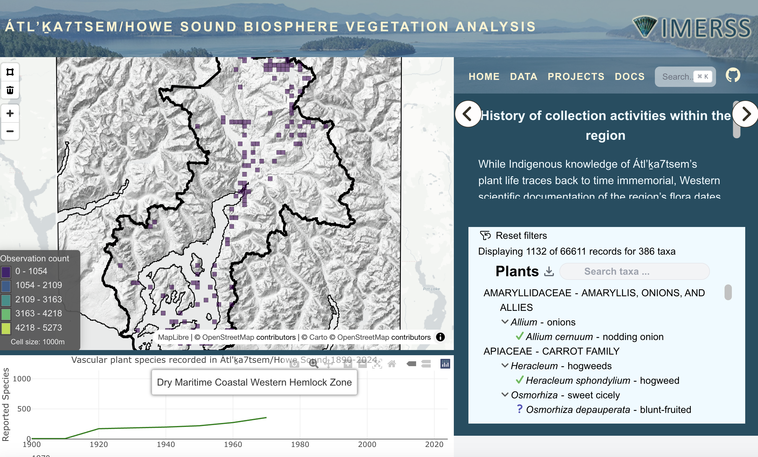
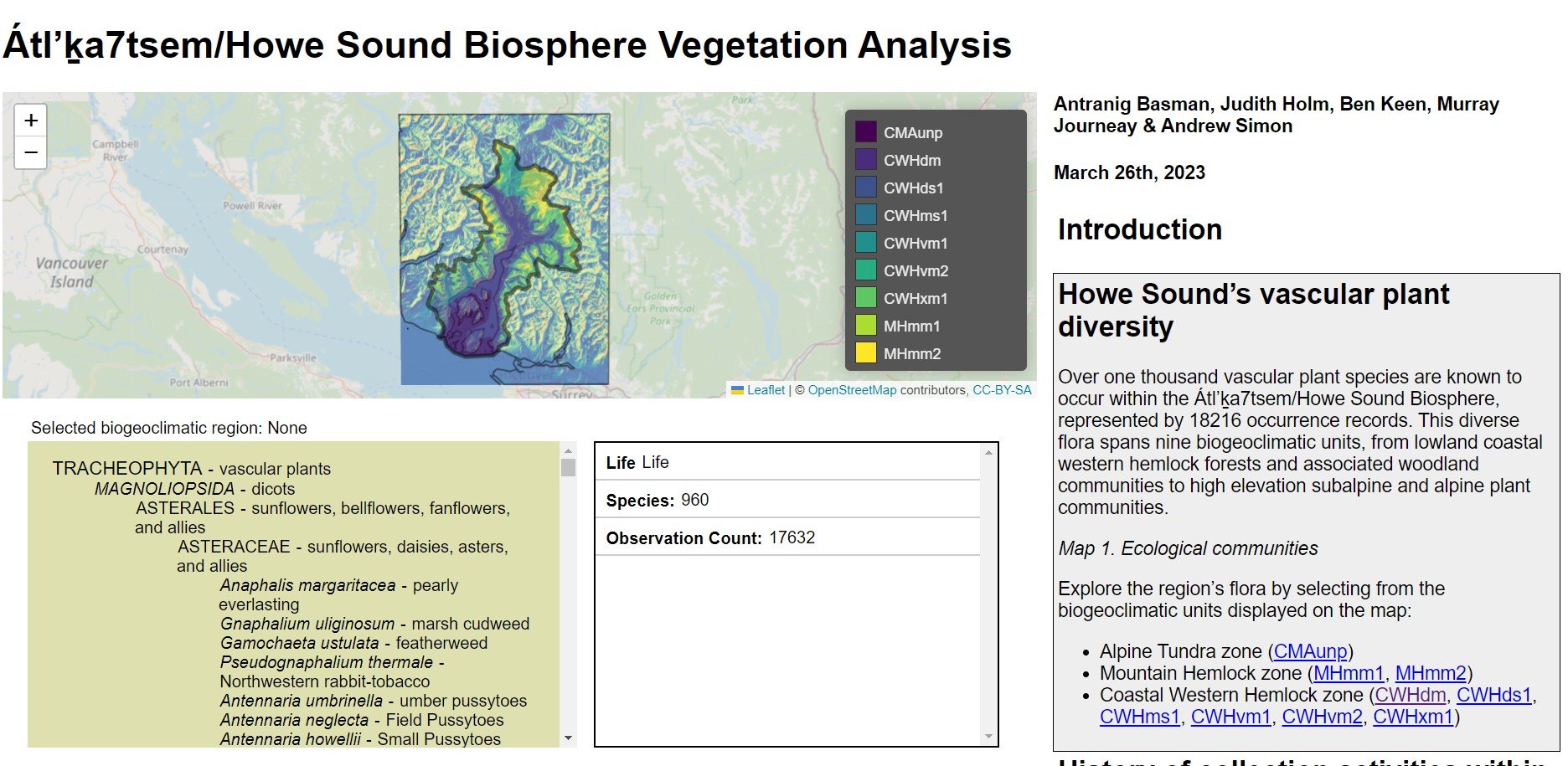
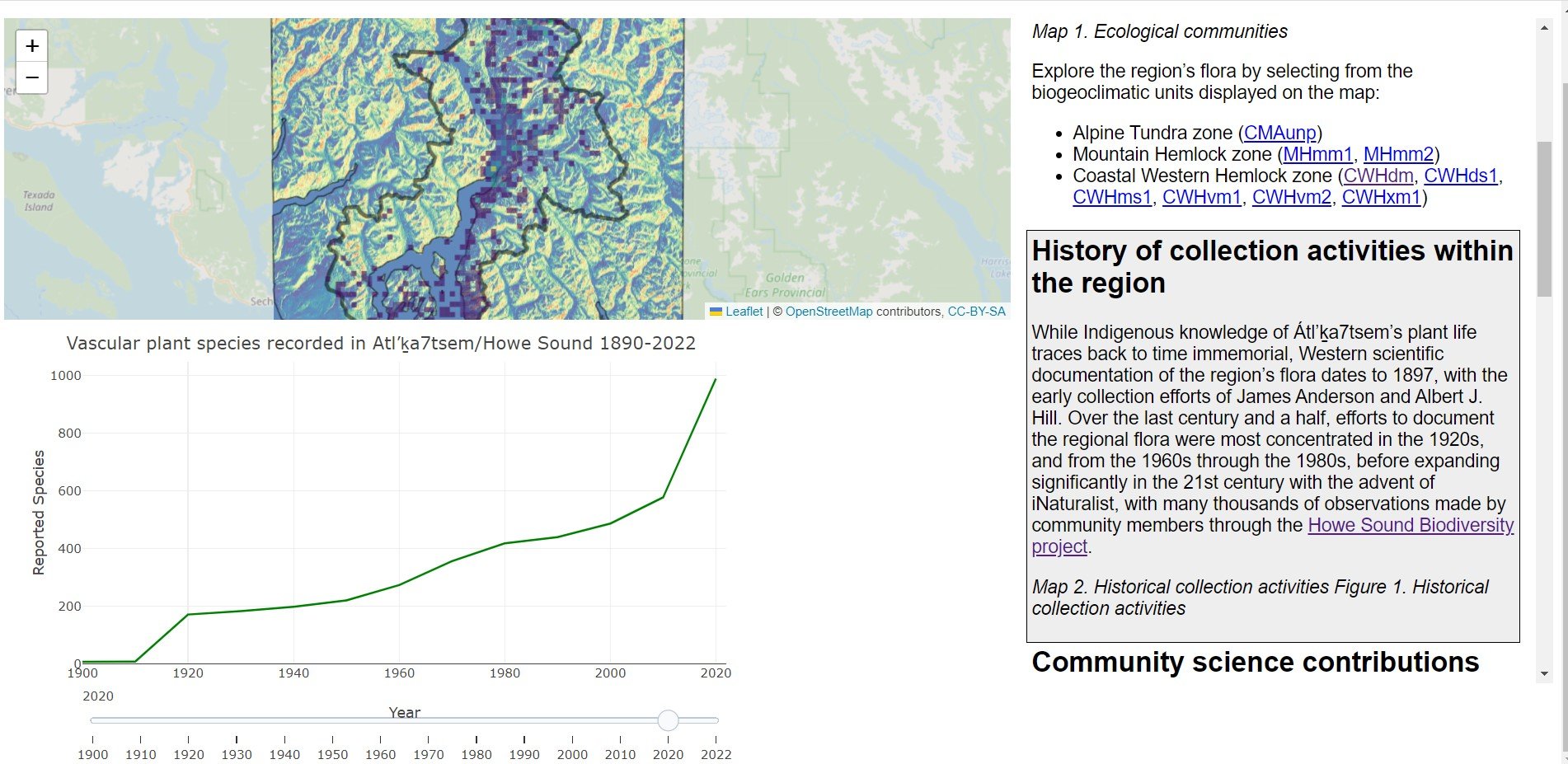
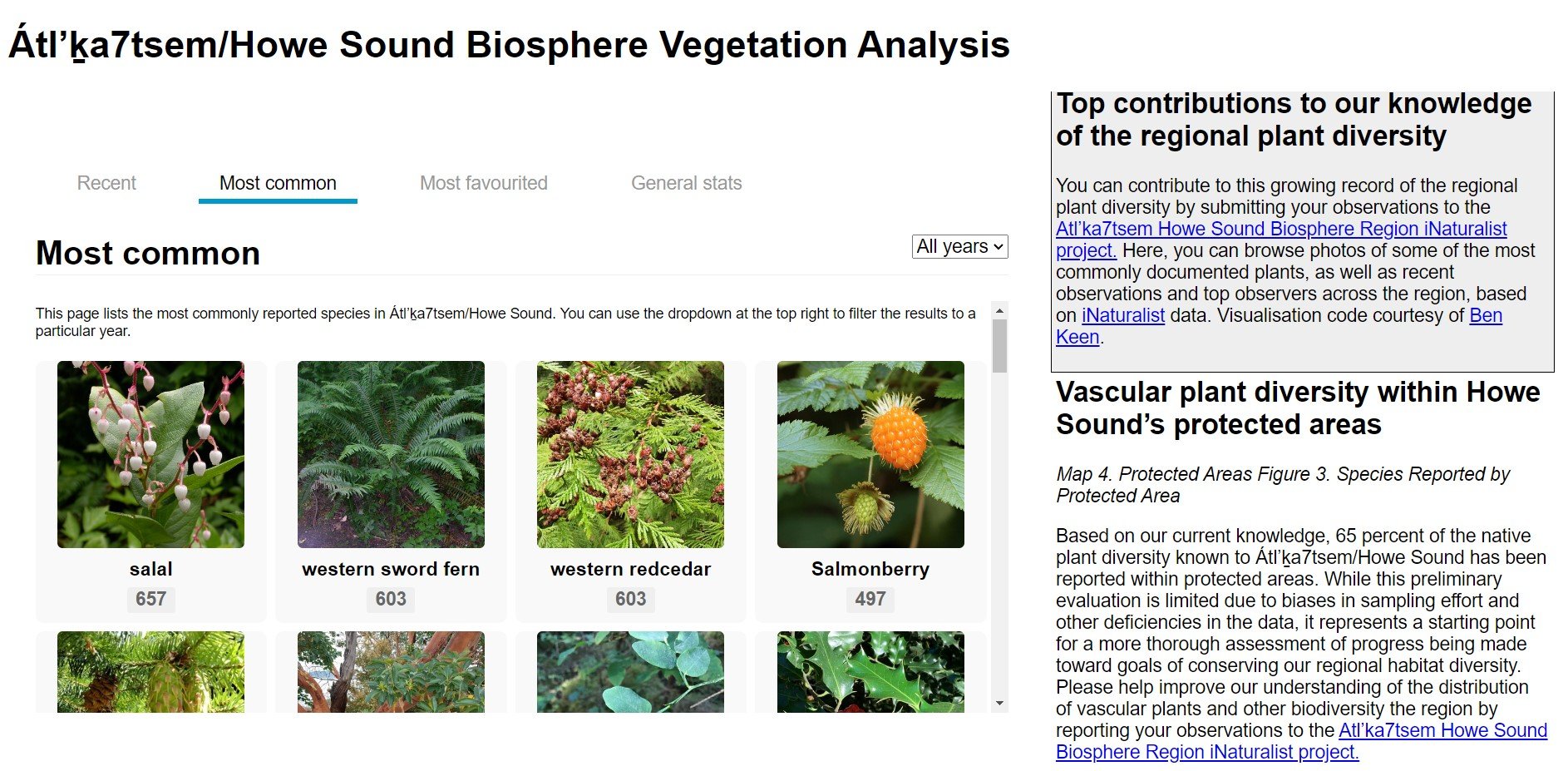
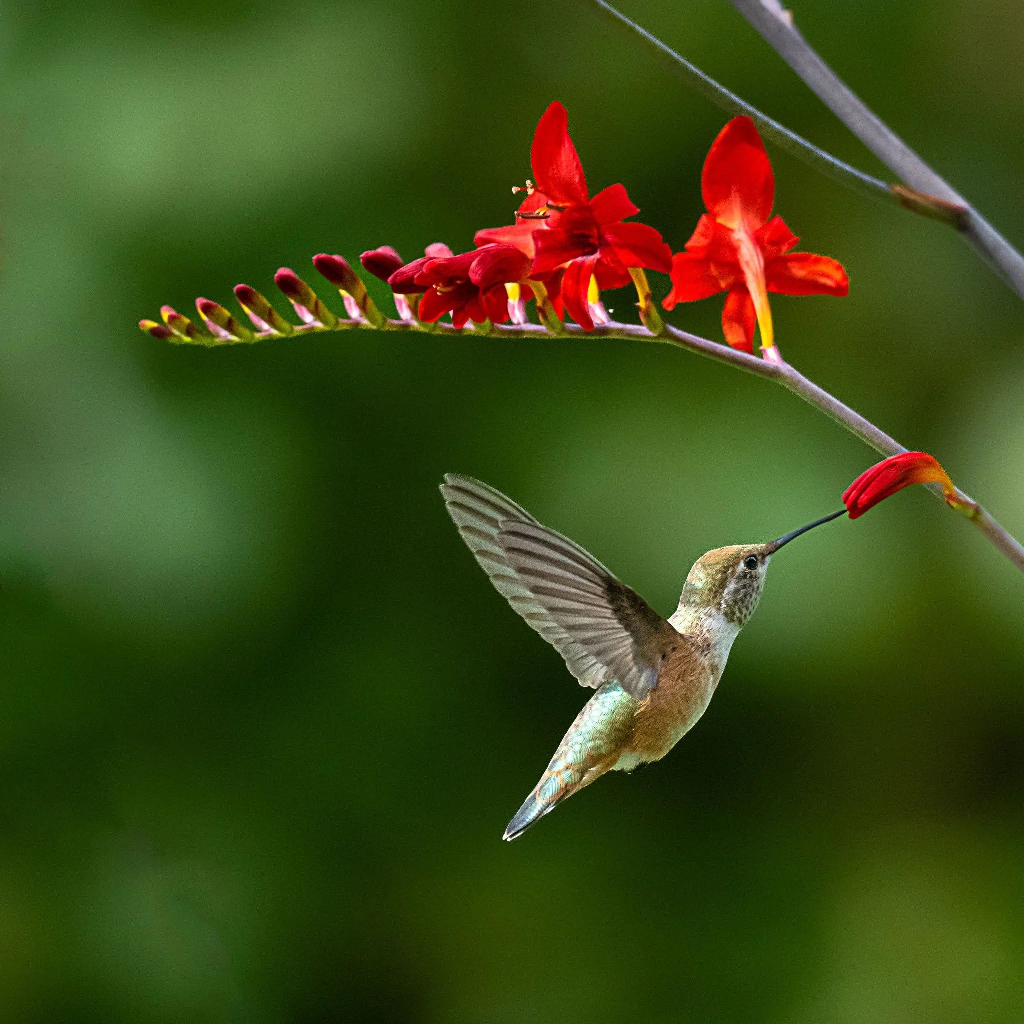
The spatial dataset visualizing habitat and species diversity in Howe Sound is well underway, with photos of what this platform will look like below. The link to this platform will be provided here in the coming months. These datasets will also be found within the Wildlife Connectivity Project website Ecoscapes, as these projects are connected.
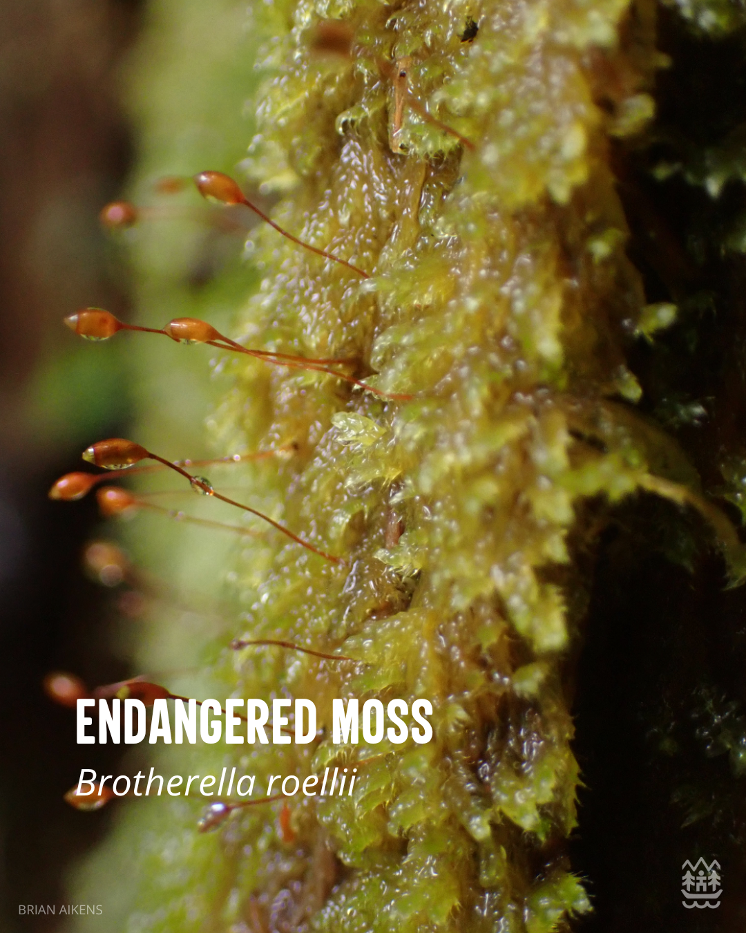
Andrew Simon has been studying Brotherella roellii, an Endangered moss species endemic to Canada, found only in the lowland riparian forests of southern British Columbia. Once present in the United States, it is now believed to be extirpated from its former American range, making its Canadian populations especially important. In Canada, it is known to occur in Howe Sound, the Lower Mainland, and the Fraser Valley.
A recent rediscovery by Andrew Simon confirmed the moss is still present at a site where it was first recorded in 1916 and last seen in 2006 which is within the Howe Sound Biosphere Region. A preliminary assessment suggests this population is healthy and possibly one of the most robust in the Howe Sound region, offering hope for its continued survival. As development fragments natural ecosystems, these refuges become critical for species like Brotherella roellii, which depend on shaded, moist environments and may be vulnerable to climate change. Andrew's current research focuses on the abiotic conditions that support this moss, aiming to understand what limits its distribution.